


(CAPITOL CITY NOW) – The combination of holiday travel and it being the first snow of the year will make for an interesting Saturday, based on information the National Weather Service in Lincoln shared during a webinar over the noon hour Wednesday.
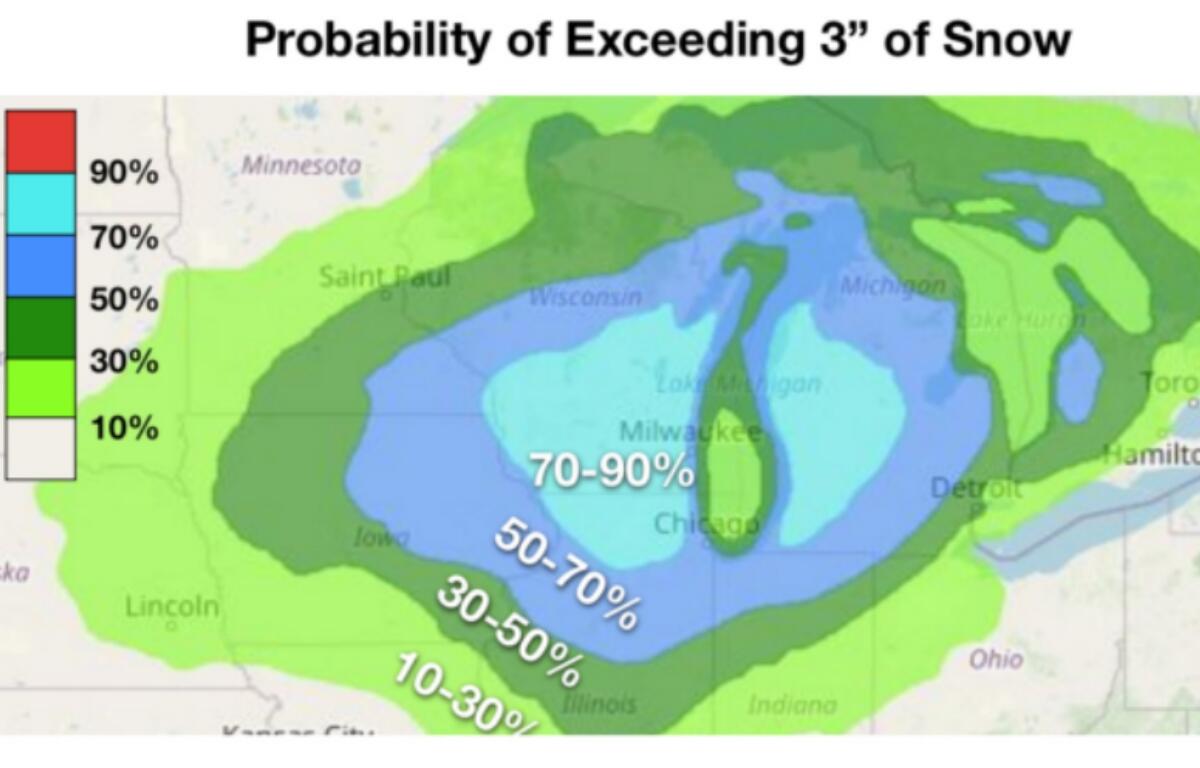
This is subject to change because the system is not even due on the west coast until Thanksgiving evening, but the Springfield area now has a 50 percent chance to get three or more inches of snow between late Friday and afternoon Saturday.
“Maybe when things first start (Friday evening), you get a little bit more of a fluffy snow, but it very quickly transitions to a wet and heavy snow,” said meteorologist Alex Erwin. “As you go into the afternoon on Saturday, you can see those values really shifting towards wet and heavy and (then an) expected changeover to rain during the evening hours.”
There is now a 40 percent chance of single-digit temperatures Friday night and Saturday night. Neither freezing rain nor sleet is expected, but the next system could bring more snow in the second half of next week.