


Lincoln, IL (CAPITOL CITY NOW) – The Springfield area is just outside of the serious possibility of tornadoes over the next two days, but that doesn’t mean the weather situation is good here.
National Weather Service meteorologist John Bumgardner in Lincoln says the area could see several rounds of storms, with the worst likely being to the north and west.
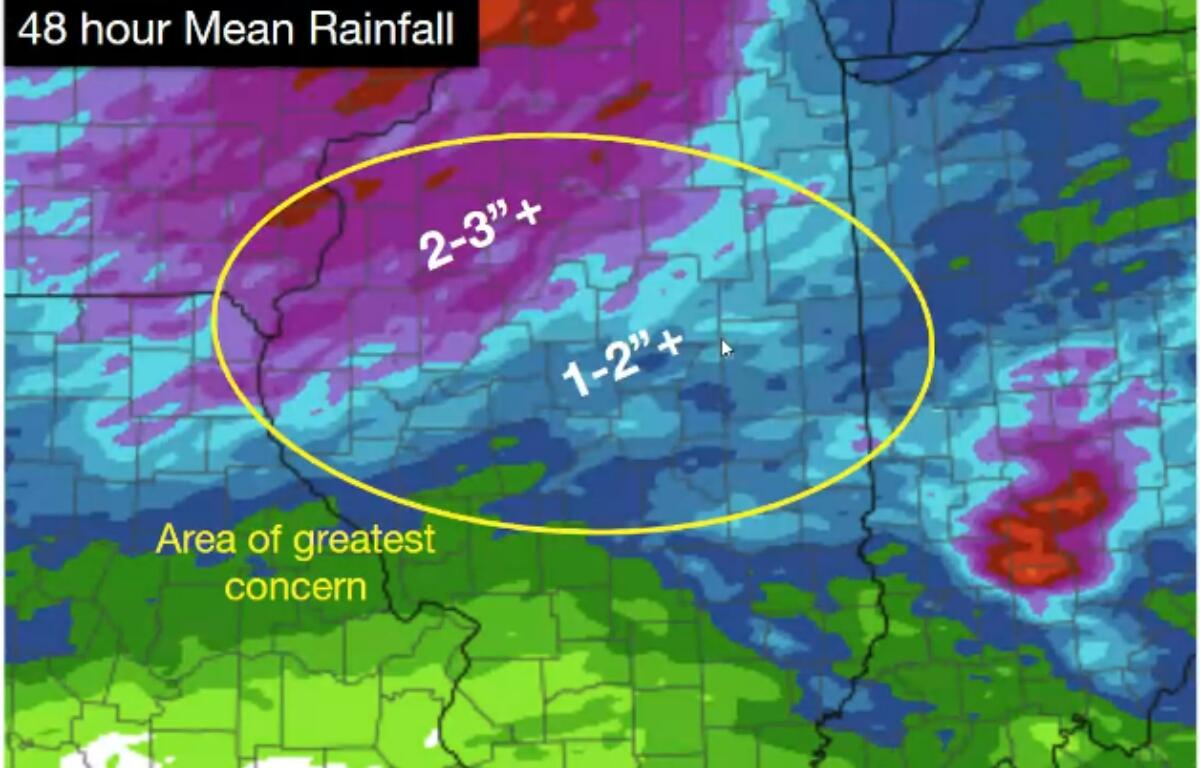
But Bumgardner says we’re in for a lot more rain.
“The northern part of this area will have the highest chance for flooding, and probably, really, the highest chance for severe weather as well,” said Bumgardner. “The storms kind of lose that fuel as the sun goes down and we get further and further into the night. But there’s a lower risk for flash flooding along and south of the I-72 corridor.”
Bumgardner says some areas north of Springfield could get two to three inches of rain over the next 24 hours or more.
Hail and straight-line winds are also possible.
“We’re not expecting, at this time, a derecho or something quite that organized,” said Bumgardner. “But, there will be pockets of some pretty strong winds, because we have a lot of instability, a lot of fuel for thunderstorms — not as much wind shear, so it shouldn’t be quite as organized like we’d see in a derecho event.”
Outside of the storm changes, forecasters are continuing to warn of heat, with highs in the 90’s and heat index values over 100 through Thursday. Temperatures will start to cool off some Friday, with highs only in the upper 70’s by Sunday.