

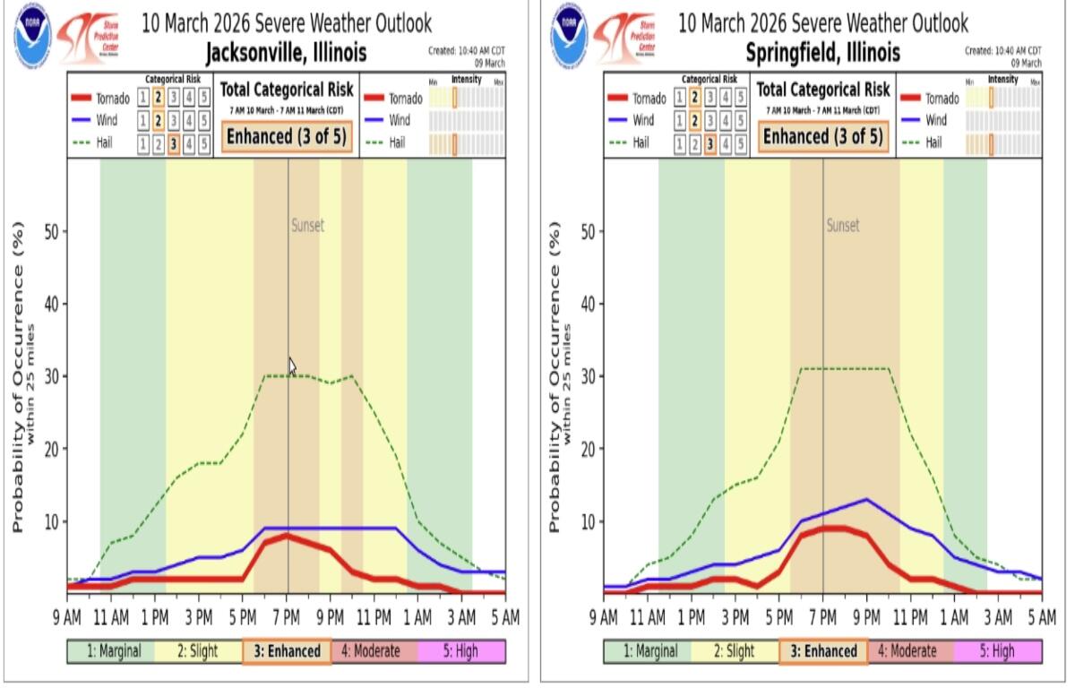

Lincoln, IL (CAPITOL CITY NOW) – The Springfield area is in under an “enhanced” risk for severe weather Tuesday.
Meteorologist Daryl Onton at the National Weather Service in Lincoln says storms could come in two waves — the worst of those during the late-afternoon and evening hours.
“These storms initially along the warm front we’re expecting to be discreet super cells, with all hazards possible — damaging wind, but more notable some tornadoes — possibly significant ones — and large hail,” said Onton, Monday afternoon. “These types of storms are generally the ones responsible for anything that’s larger than golf ball size.”
Of all the weather possible, Onton says hail may be the biggest threat.
“We are looking for a 30 percent or higher chance of severe hail, near and north of I-72. For the most part, that super cellular mode can produce two inch diameter or larger hail,” said Onton, which could make it as large as baseball size.
Onton says the second round of storms will be late-evening and overnight, with heavy rain and high winds possible. Tornadoes will not be as much of a threat.
Rain totals could be between a half and one inch in Springfield, but some pockets in central Illinois could be double that.
Another update from the National Weather Service is expected to be late Tuesday morning.
Stay with Newstalk 93.9 and AM 1240 WTAX, and CapitolCityNow.com, for any further details. If warnings are issued Tuesday, you’ll hear them first on the radio.