

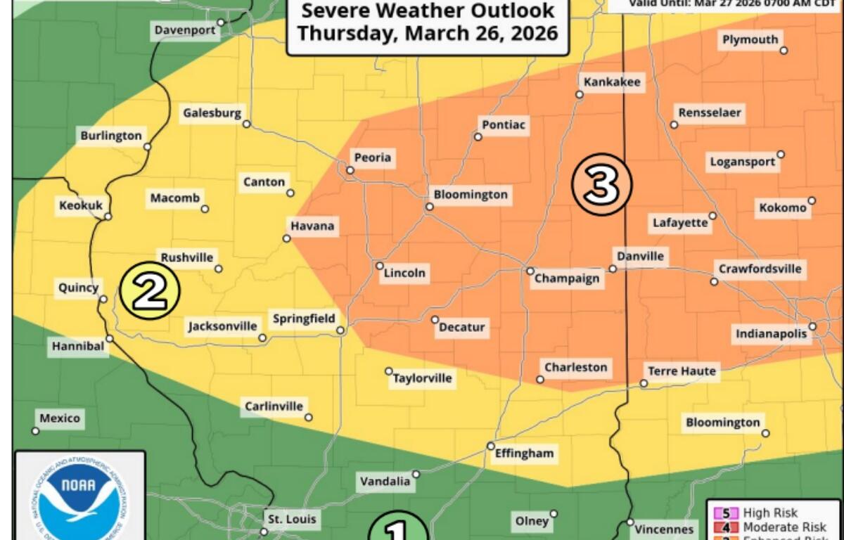

Lincoln, IL (CAPITOL CITY NOW) – Stop us if you’ve heard this one before. There’s a possibility of severe weather throughout a good portion of the state Thursday. Then, a sharp drop in temperatures tonight, followed by a colder day Friday.
“It looks like the wind shifts out of the north (after 6pm Thursday),” said Ed Shimon, Warning Coordination Meteorologist, National Weather Service Lincoln, IL. “Around 8pm, the winds are due north, and they start cranking 20, gusts to 40 (miles per hour). The temperature drops starting around 6pm when that front hits, then (temperatures) drops about 35 degrees in about four to five hours.”
Low temperatures in parts of the area could end up being 50 degrees less than the daytime highs, Shimon says.
But before that, Shimon says there is either a slight, or enhanced risk of severe weather starting in the late afternoon Thursday.
Springfield is right on the dividing line between enhanced and slight, with tornadoes a possibility.
“(The threat) isn’t as high as we’ve seen in a previous event. But a five (percent tornado threat) is definitely something to be concerned about…EF-2…what the Storm Prediction Center is thinking.”
Large hail up to two inches in diameter is possible, especially in the areas under an enhanced risk.
Shimon says storms will start in the northeastern portion of the state before extending their way south.
Watches, and warnings, can be heard as soon as they’re issued on Newstalk 93.9 & AM 1240 WTAX, with forecast updates also available on the weather forecast page of CapitolCityNow.com.