


UPDATED 12:45 p.m.
Lincoln, IL (CAPITOL CITY NOW) – There are things both known, and unknown, about what could be two rounds of, at least, heavy weather expected to envelop especially the Springfield area later Tuesday.
What’s known about the weather is that overnight Tuesday night into Wednesday morning, it will likely be more of an event of both high winds and heavy rain, says Meteorologist Rebekka Copple at the National Weather Service (NWS) in Lincoln.
“We’re going to get more coverage, and we’re going to start transitioning into more of a wind threat as it becomes more linear,” said Copple. “This is where we could start to see some…areas with higher rainfall amounts.”
Copple says the rain in Springfield could be 1 to 1.5 inches by Wednesday, but some parts of the region could see double that total.
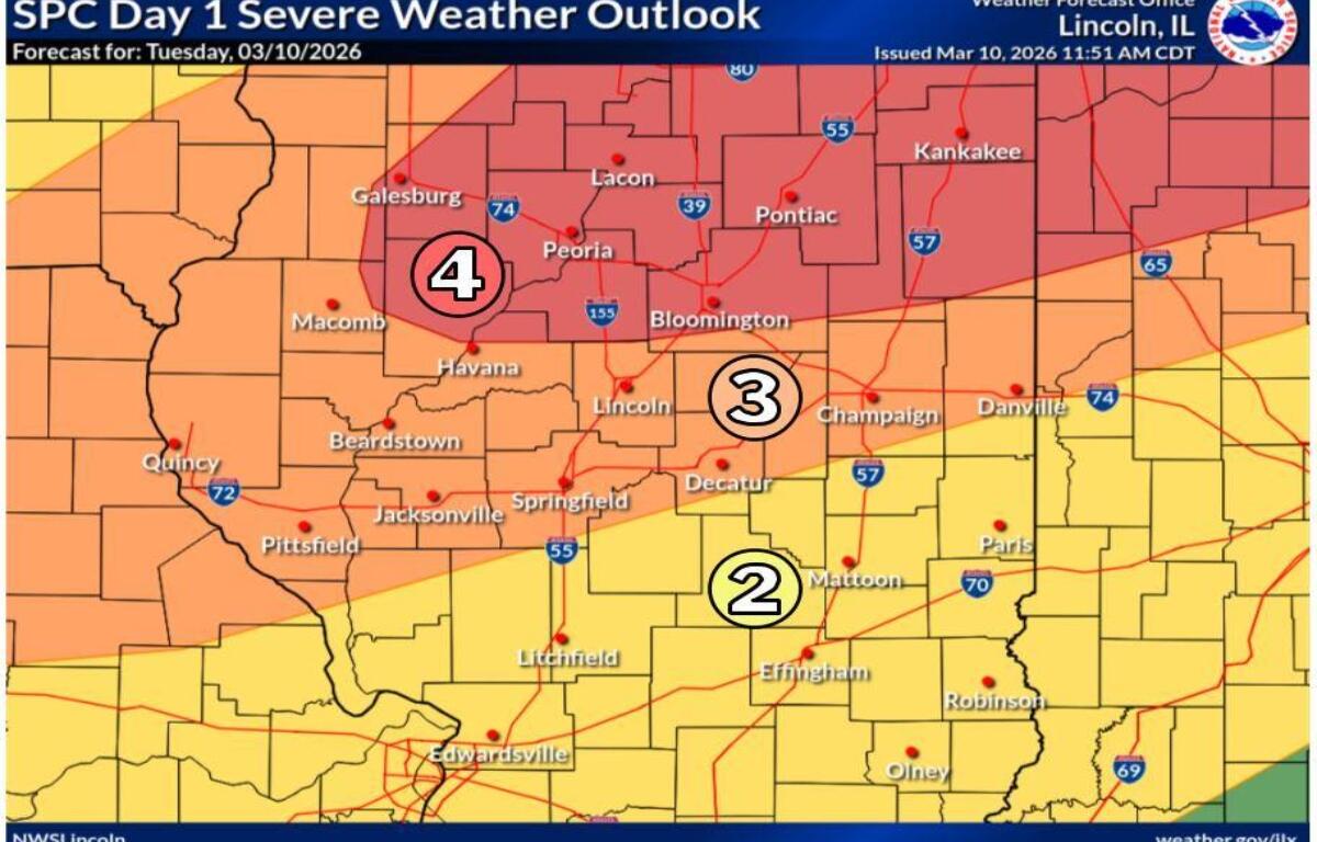
Before that, Copple says is when the more severe storms and tornadoes as high as EF-3 could form, but that depends on when and if a cap that prevents storms from happening, could be broken. At the time of this posting, the Storm Prediction Center was preparing to increase parts of Northern and Central Illinois into a Level 4 out of 5 scale. But the Springfield area is still in an “enhanced” risk.
As for where the first round of storms — and the potential for tornadoes — could hit?
“We’re going to see storms all over the place,” said Copple. “The strongest storms…looks like it’s going to be primarily along and north of I-72, but we’re going to see potentially severe storms across our entire forecast area.”
Rain could continue through the morning hours Wednesday.
If severe weather breaks out, we’ll bring you the latest warnings and details on Newstalk 93.9 & AM 1240 WTAX first, and here on CapitolCityNow.com.