


(CAPITOL CITY NOW) – Severe weather is a factor Thursday, the National Weather Service says.
“We still are expecting thunderstorms to move through this afternoon and evening,” said Nicole Albano, a meteorologist at the NWS office in Lincoln. “Tornadoes, damaging winds, and large hail are all possible again, and then we are dealing with some hot and humid conditions ahead of the storms.”
The heat index is predicted to top out at 100 around 4 p.m., with the severe storms in evidence between 6 and 9 p.m.
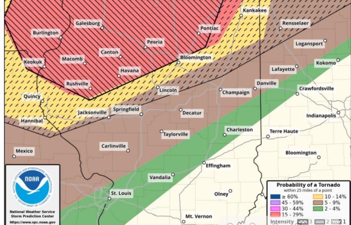
“We do not have a confirmed tornado” for the Springfield area Wednesday night, said Albano. “We did issue a warning. We did issue an observed tornado in our warning, because there is a debris signature that we saw. We have not sent out any surveys at this time, and we probably will not get to that until (Friday). We have not declared any findings yet, but we will get to that as soon as we can.”
Springfield is at an “enhanced” risk, which is the third most serious of five categories.